Scientific Validation
We Offer Data-Driven Groundwater Targeting
We’re not into guesswork when it comes to your drilling investment. Instead, we believe in applying real scientific principles to ensure your project goes smoothly. HydroScan™ applies established geophysical principles used in energy and resource exploration to improve groundwater targeting accuracy before drilling begins.
Instead of relying on outdated information or guesswork, HydroScan™ evaluates measurable subsurface properties to identify conductive geological zones that may correlate with groundwater-bearing formations. We help you find water the first time.
The Science Behind Finding Water, Every Time
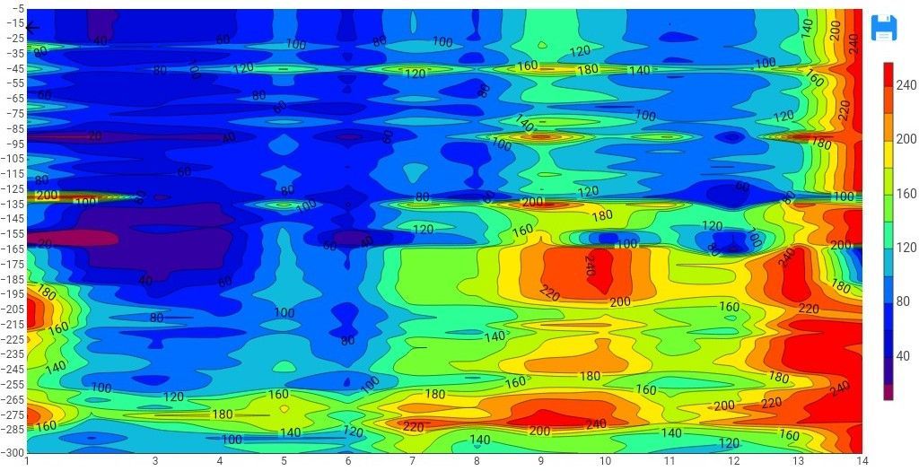
How does the HydroScan™ technology work? The science shows that different subsurface materials conduct electricity differently. Water-filled formations often show higher electrical conductivity, distinct resistivity signatures, and measurable contrasts compared to dry rock or compacted sediment. That means these are the factors we should be checking for before drilling — and HydroScan™ technology does just that.
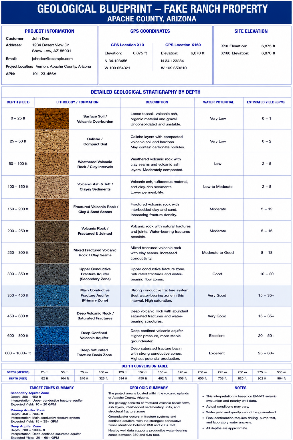
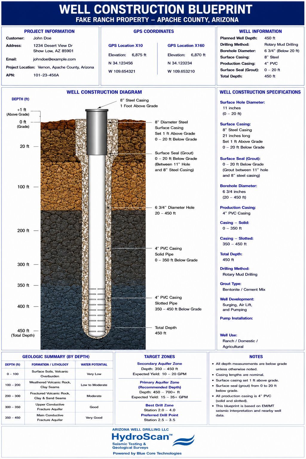
HydroScan™ measures these variations using electromagnetic and magnetotelluric techniques, allowing for interpretation of:
✔ Geological structures
✔ Potential aquifer zones
✔ Subsurface layering.
What Level of Accuracy Can Be Expected?
No geophysical technology can guarantee groundwater with 100% certainty because natural geological conditions vary. However, when properly applied and interpreted, HydroScan™ geophysical methods have demonstrated approximately 85–90% proven targeting accuracy in identifying conductive geological features associated with potential groundwater zones. This represents a significant improvement over traditional well placement methods based solely on nearby wells or surface observations.

Traditional Well Placement vs HydroScan™
Traditional Well Placement
❌ Based on nearby wells only
❌ High variability
❌ Increased risk of dry or low-yield wells
❌ Limited subsurface understanding
HydroScan™ Methodology
✅ Subsurface geophysical imaging
✅ Data-driven targeting
✅ Geological risk analysis
✅ Engineering interpretation.
Is Water Guaranteed?
HydroScan™ provides geophysical interpretation — not a guarantee. Factors such as local geological complexity, drilling execution, and aquifer variability influence results. HydroScan™ is designed to significantly reduce risk — not eliminate uncertainty entirely.
By combining established geophysical science with engineering interpretation, HydroScan™ provides a structured, data-driven approach to groundwater exploration. This allows you and your drilling team to improve decision-making and reduces the risks associated with drilling without subsurface analysis.
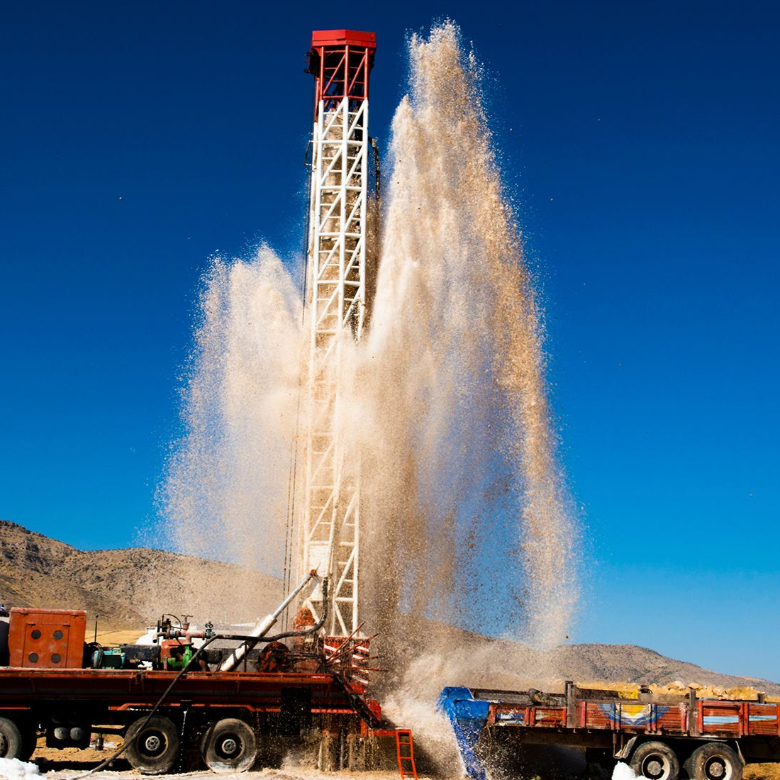
Drill With Data — Not Guesswork
Don’t gamble with your drilling investment. Make a data-driven decision with the information that comes with a HydroScan™ evaluation. Schedule your evaluation today and identify groundwater potential before drilling begins.